
Cape Jaffa Marina Sand and Dredge Management Plan
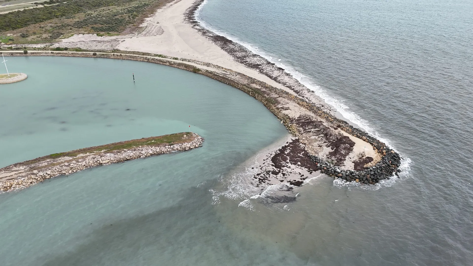
A sand and dredge management plan for the Cape Jaffa Anchorage on South Australia's Limestone Coast, built on wave and sediment transport modelling, that moves the marina from emergency dredging to a planned, trigger based maintenance program.
The challenge
Cape Jaffa Anchorage sits at the southern end of Lacepede Bay on the Limestone Coast, directly in the path of one of the more active longshore sediment transport systems in South Australia. Sand travels west to east along this shoreline in very large volumes, and the marina's breakwaters stand in its way. Sedimentation has been a maintenance reality since the anchorage opened in 2007, but the scale of it changed in 2024, when an extended run of high energy storms drove more than 110,000 cubic metres of sand toward the marina, closed the entrance channel and forced an emergency dredging campaign. Kingston District Council needed to know how much sand is genuinely arriving each year, and to replace reactive emergency response with a program it could schedule and rely on. The beach immediately east of the entrance carries the other half of the problem, having steadily lost sand of its own.
Our approach
Safe navigable depth at the anchorage entrance, held through the year rather than recovered after the channel shoals, is the criterion the whole plan is written to meet, and the plan sets measurable targets against it. Meeting that criterion meant first quantifying how much sand genuinely arrives. A ten year numerical simulation of the local wave climate and longshore sediment transport was run at six cross shore profiles and anchored to hard evidence: successive bathymetric surveys either side of the 2024 storm sequence, long running beach profile records, sediment sampling and particle size testing, and the dredge records from every campaign since the anchorage opened. Close analysis of the August and September 2024 storms then showed how much material one extended event can move, and how quickly. Those figures set the physical dimensions of the response, the size and working depth of the sand trap, how often it fills, and the survey level that should trigger a campaign. Practicality was the last filter, because dredging plant on this coast has to work to the tides, the season, site access and a mobilisation lead time measured in weeks.
The outcome
The plan gives Kingston District Council a defined sand trap west of the breakwater, sized and set to a working level that intercepts sand before it reaches the entrance channel, together with survey and trigger thresholds that say when to dredge instead of waiting for the channel to shoal. Dredging targets are set by condition rather than by habit, with a typical year, a high energy storm year and a quiet year each carrying their own volume and frequency. Dredged sand is directed straight onto the eroding eastern beach as nourishment, so material taken out of the system is returned where the coast needs it and the sediment budget across the entrance stays closer to balance. A monitoring and review framework of biannual surveys and post storm inspections lets Council refine the program as the western beach draws down and the trap begins to do its work. For the recreational boating, fishing and tourism activity the anchorage supports, the outcome is a marina entrance that stays navigable through the year, managed to a plan rather than to an emergency.
Similar work
Talk to us about a similar project, or browse more of our work.