
Port Noarlunga Coastal Adaptation Study
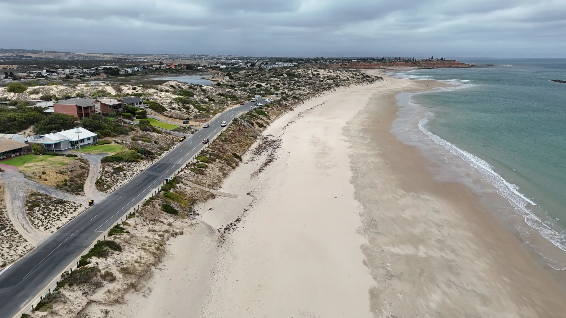
Coastal process modelling and adaptation study for Port Noarlunga, South Port Beach and the Onkaparinga Estuary in South Australia, quantifying erosion and flooding hazards through to 2100 and setting out ranked concept adaptation options for the City of Onkaparinga.
The challenge
The Port Noarlunga coastline carries an unusual concentration of public value in a short stretch: a jetty, two surf life saving clubs, the Esplanade, a limestone reef and a river mouth, all on a shoreline that has been shifting for decades. Beach monitoring profiles going back to 1975 show the beach face and intertidal zone steadily lowering, and the storms of May and June 2025 cut roughly twenty three metres of horizontal recession into the South Port dunes. Behind the beach, the Onkaparinga Estuary floodplain faces a different hazard again, where river flooding and storm surge can arrive together. Several studies had examined parts of the problem over the years without joining them up. The City of Onkaparinga needed one coherent, technically defensible picture of how the whole system behaves, and a view on where effort should be directed first.
Our approach
A fifty year design life under AS 4997, and the Coast Protection Board's allowance of 0.3 metres of sea level rise by 2050 with capacity for a metre by 2100, set the terms of the study before any option was drawn. Meeting a horizon that long meant establishing how this shoreline behaves now, so beach profile records running back to 1975, satellite derived shoreline change, RTK survey and on ground inspection were read together first. One finding reset the brief: the Port Noarlunga reef refracts enough wave energy to reverse the usual Gulf St Vincent longshore direction, so sand here travels north to south, and a design that ignored that would keep losing it. Numerical modelling of waves, water levels, beach profile response and sediment transport then put figures to the same behaviour, quantifying storm setback, transport rates, recession driven by sea level rise, and the movement of flood and surge water through the estuary. Those results went straight into the option development, which ran cell by cell and was tested through a multi-criteria assessment weighing coastal performance, constructability, environmental and social impact, and long term maintenance. Two flood mitigation concepts were modelled in their own right, so their performance, and their limits, could be judged on results rather than expectation.
The outcome
The study gives the City of Onkaparinga a single evidence base for the whole Port Noarlunga and South Port shoreline, with erosion setbacks and inundation extents quantified for 2050 and 2100 and a clear risk rating for each coastal cell and key asset. From that, a ranked suite of concept adaptation options is set out, ranging from rock and geotextile sand container revetments and hybrid dune structures that hold the line while keeping a natural dune appearance, through levee and floodplain storage measures in the estuary, to landward relocation where the long term hazard cannot reasonably be held. Council can now prioritise and stage works on the basis of modelled outcomes rather than reaction to the last storm, and take a defensible technical position into community and stakeholder conversations. For the beaches, dunes and public facilities at Port Noarlunga and South Port Beach, it is a practical pathway to keeping a well used stretch of the South Australian coast safe, accessible and protected as sea levels rise.
Project gallery
Similar work
Talk to us about a similar project, or browse more of our work.