
Semaphore Surf Life Saving Club Coastal Adaptation
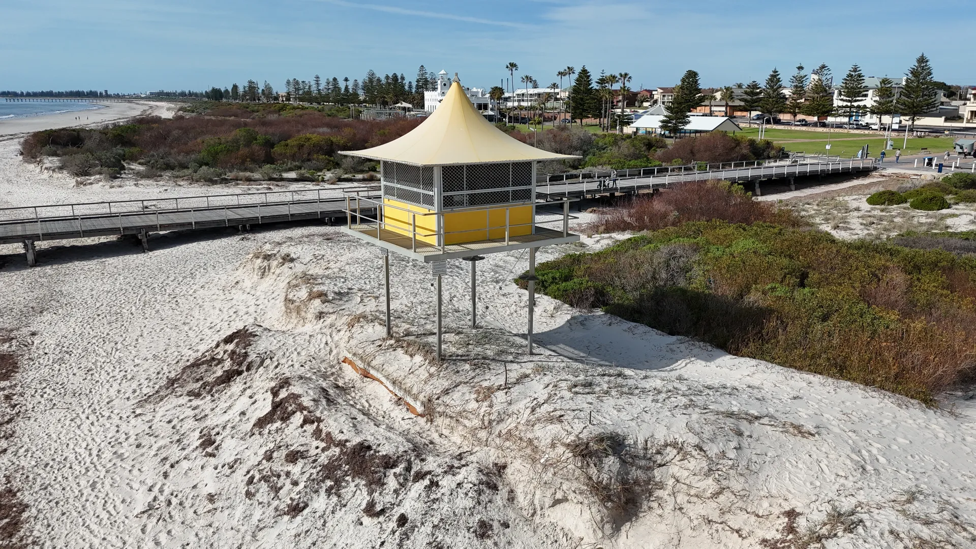
Coastal erosion hazard assessment and adaptation concept design for the Semaphore Surf Life Saving Club watch tower on Semaphore Beach, South Australia. The work quantifies how far the shoreline is likely to retreat by 2050 and sets out a relocation and footing design that keeps the tower in service.
The challenge
The Semaphore Surf Life Saving Club watch tower stands on the frontal dune of Semaphore Beach, on the Adelaide metropolitan coast, and gives patrolling volunteers their sightline along the sand. Storm events in 2025 cut deeply into the dune in front of it and exposed its concrete slab footing, prompting the City of Port Adelaide Enfield to place emergency sand nourishment to buy the tower some buffer. The longer view was the real concern. Satellite imagery and the beach profile monitored at Semaphore since 1975 both show a shoreline that has been receding for over a decade and a beach face that no longer recovers fully between storms, leaving the tower increasingly exposed to coastal erosion and sea level rise. Council needed to know how much ground would be lost by 2050 and what could sensibly be done about it, and needed an answer that kept the tower working for surf life saving rather than simply writing the asset off.
Our approach
Two requirements pulled against each other at Semaphore. The tower needed to sit far enough back to stay clear of the shoreline as it retreats towards 2050, and it needed to stay close enough to the water to keep the sightline that patrolling volunteers rely on. Resolving that meant putting a defensible number on the hazard before any option was ranked, so wave climate across Gulf St Vincent, five decades of monitored beach profile data at Semaphore, satellite derived shoreline change and fresh site survey were brought together into an erosion hazard assessment built in three parts: storm cut in a one in one hundred year event, the ongoing historic recession trend, and the shoreline response to sea level rise. With a setback distance grounded in measured behaviour rather than a rule of thumb, the range of adaptation responses was weighed against national and South Australian coastal hazard adaptation guidance, from holding the line through to retreat. The trade-off was then settled by splitting it in two, moving the tower a workable distance landward and founding it deep enough that the shoreline can keep receding past the footings without the structure having to move again.
The outcome
The assessment puts a figure on the hazard, a combined shoreline setback of roughly 45 metres by 2050 once storm erosion, historic recession and sea level rise are added together. Working from that, the concept design relocates the existing tower about 20 metres landward onto steel screwpiles founded well below the predicted erosion level, replacing the shallow slab so the shoreline can keep moving beneath the structure without undermining it. The tower superstructure is lifted and reused as it stands, and the foredune at the new location is regraded and nourished to restore the platform level, so volunteers keep the same height and the same sightline to the water without additional stairs or access. Depth markers painted on the pile shafts give the City of Port Adelaide Enfield a simple visual trigger for the next adaptation decision as erosion progresses. It is a practical, buildable way to keep a working surf life saving asset on an eroding beach for its remaining design life, rather than defending the site with a hard structure that would draw sand away from the beach in front of it.
Similar work
Talk to us about a similar project, or browse more of our work.